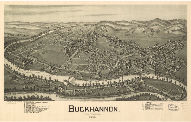
 Map held at the Library of Congress. When I was working in central West Virginia, I would often see these birds-eye view maps of small towns, like Buckhannon or Elkins. I quickly realized that there was no way the artist - the maps were signed T.M Fowler - could actually have been looking down on the city. There wasn't a hill or mountain at those angles, and he surely wasn't ascending in a balloon to get the right perspective. How did he do it?
1 Comment
Ahh... the days of public transportation...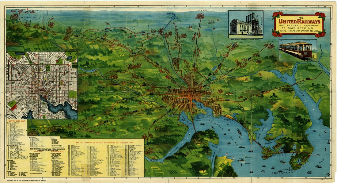 In 1910, there were an estimated 500,000 cars in the United States for the 9.2 million people in the country. In 2015, there are over 250 million cars for an estimated 320 million people.
Cities were king, and public transportation was a necessity. Unlike New York and Boston, Baltimore was not developing a system of subways that would never interfere with that car traffic (and therefore never disappear). Instead, we had the trolley/ streetcar/ street railway. This map shows the trolley for the United Railways and Electric Company, which doesn't include any larger railways that had multiple stops within the city and suburbs. The closest thing we have to the streetcar today is the light-rail, which kind of follows the Halethrope Line into the city and then the Mt. Washington Line out. The light-rail then keeps going north past Lake Roland to Timonium and Cockeysville, while the old Mt. Washington Line went to Pikesville. Some close-ups are below, and click here for the full version from Johns Hopkins University Libraries. |

Come in, the stacks are open.Away from prying eyes, damaging light, and pilfering hands, the most special collections are kept in closed stacks. You need an appointment to view the objects, letters, and books that open a door to the past. Archives
April 2023
Categories
All
|
 RSS Feed