KRISTINA R. GADDY
  • Books
    • Well of Souls
    • Flowers in the Gutter
  • Writing
  • Open Stacks Blog
  • About
    • Support My Writing
  • Contact

Come in, the stacks are open.

Maps for Well of Souls: Uncovering the Banjo's Hidden History

9/14/2022

0 Comments

 
Picture
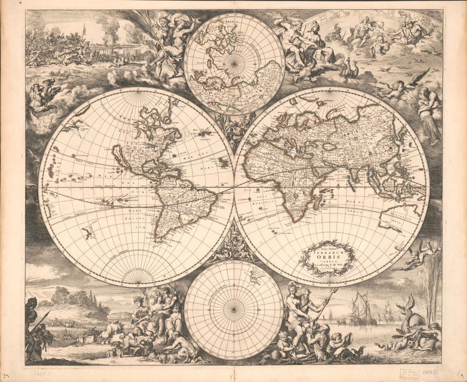
World map / Nova totius terrarum orbis tabula / Amstelodami : Ex officina F. de Wit, [1680?] / Library of Congress
     A good map almost seems necessary for a book of historical nonfiction. Unfortunately for me, the other illustrations in Well of Souls were more important than any map I wanted to include. But, that’s why I have this blog. As easy as it might be to pull up Google Maps, some place names and even landscapes have changed over the last 400+ years. Here are some maps that I came across in my research that helped me understand the places and time periods I was writing about. (Also a quick note: they are not geographically organized, but organized by the chapters to which they correspond.)

These are all in the public domain, and while some are available at the Library of Congress's website (and I've linked to them), others are from books at the James Ford Bell Library/ University of Minnesota Libraries I was able to access while there.

Picture
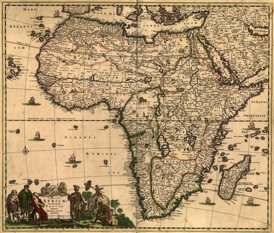
Map of Africa / Wit, Frederik De. Totius Africæ accuratissima tabula. [Amsterdam?: S.N., ?, 1688] Map.
I - The Atlantic Ocean - This c. 1688 map of the African continent shows some of the place names that some like Hans Sloane may have heard of. You see names like Loango, Angola, Benin, and Guinea, which were place names that Europeans often used to distinguish African communities from which they took people.

Link to original.​
Picture
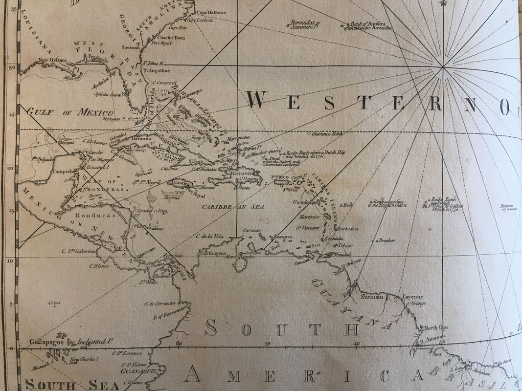
Map of the Caribbean / James Ford Bell Library, University of Minnesota Libraries
II - Jamaica - On the other side of the Atlantic Ocean, Caribbean islands saw an expansion of sugar plantations, which drove the trade in human beings from Africa.
Picture
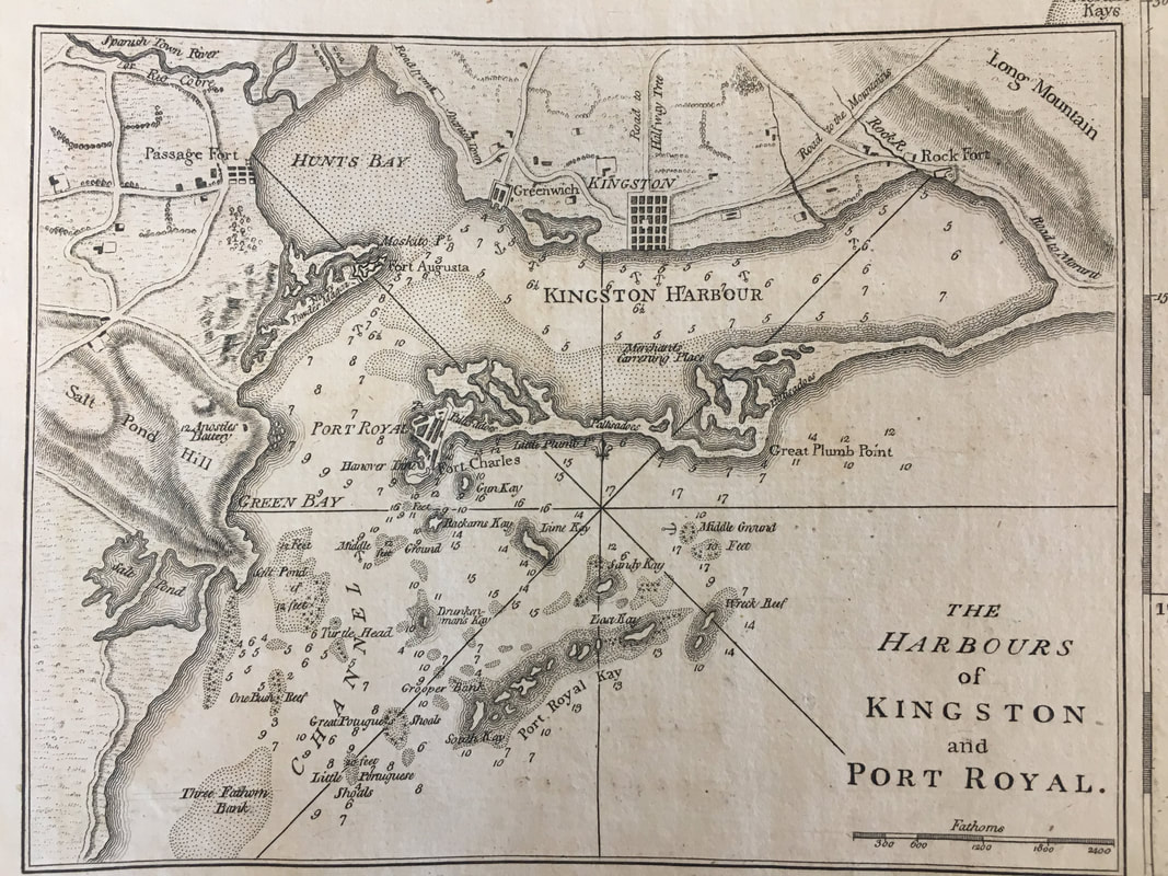
The Harbours of Kingston and Port Royal Jamaica / James Ford Bell Library, University of Minnesota Libraries
II - Jamaica - Hans Sloane went to Jamaica as the new Governor’s physician. Before the earthquake of 1692, Port Royal was the commercial hub not just for the island, but the whole British Caribbean. The earthquake caused most of the city to sink.
Picture
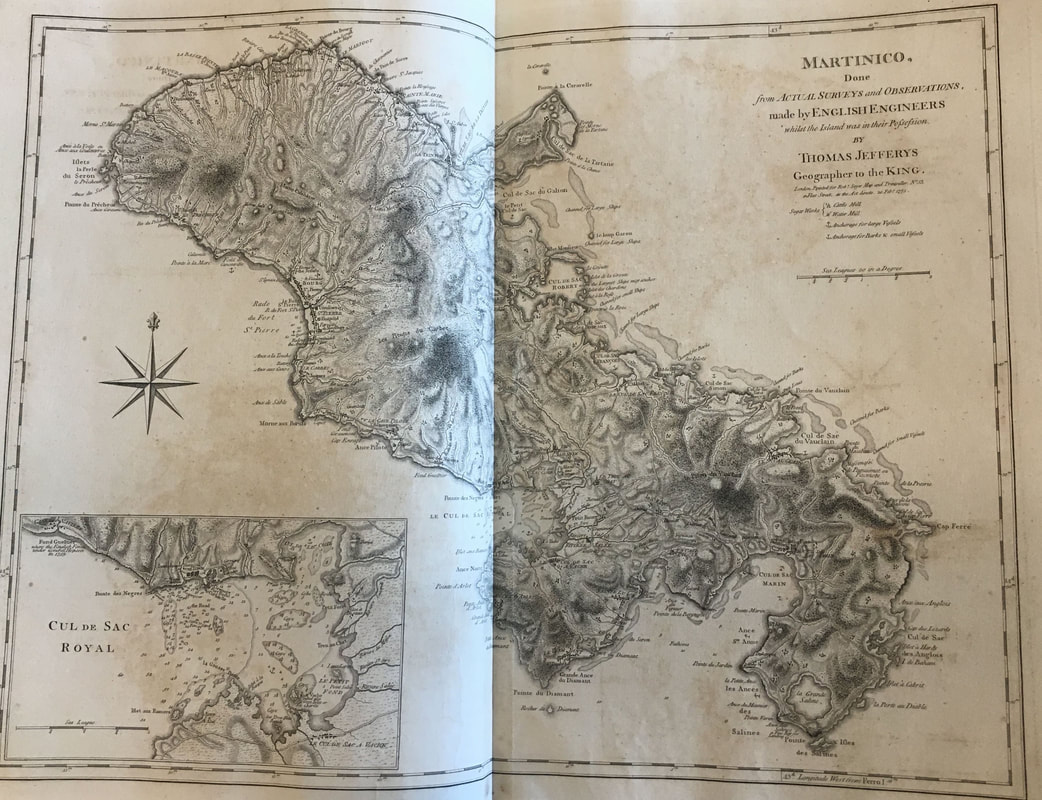
Martinique / James Ford Bell Library, University of Minnesota Libraries
III - Martinique - Father Jean-Baptiste Labat arrived in Martinique at Ft. Saint Pierre, on the east side of the island. Although small, Martinique is quite mountainous, and he had to make his way across the island to where he would be working. ​
Picture
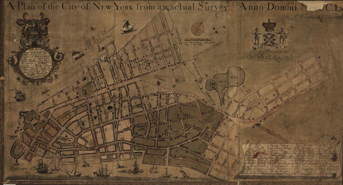
A map of the city plan of New York / Library of Congress
IV - New York - This 1755 map of the City of New York, shows it confined to lower Manhattan with the Common and Negro Burial Ground labeled. The first time the burial ground appeared on a map was in 1735, but the first burials could have been as early as the 1650s.

Link to original.
Picture
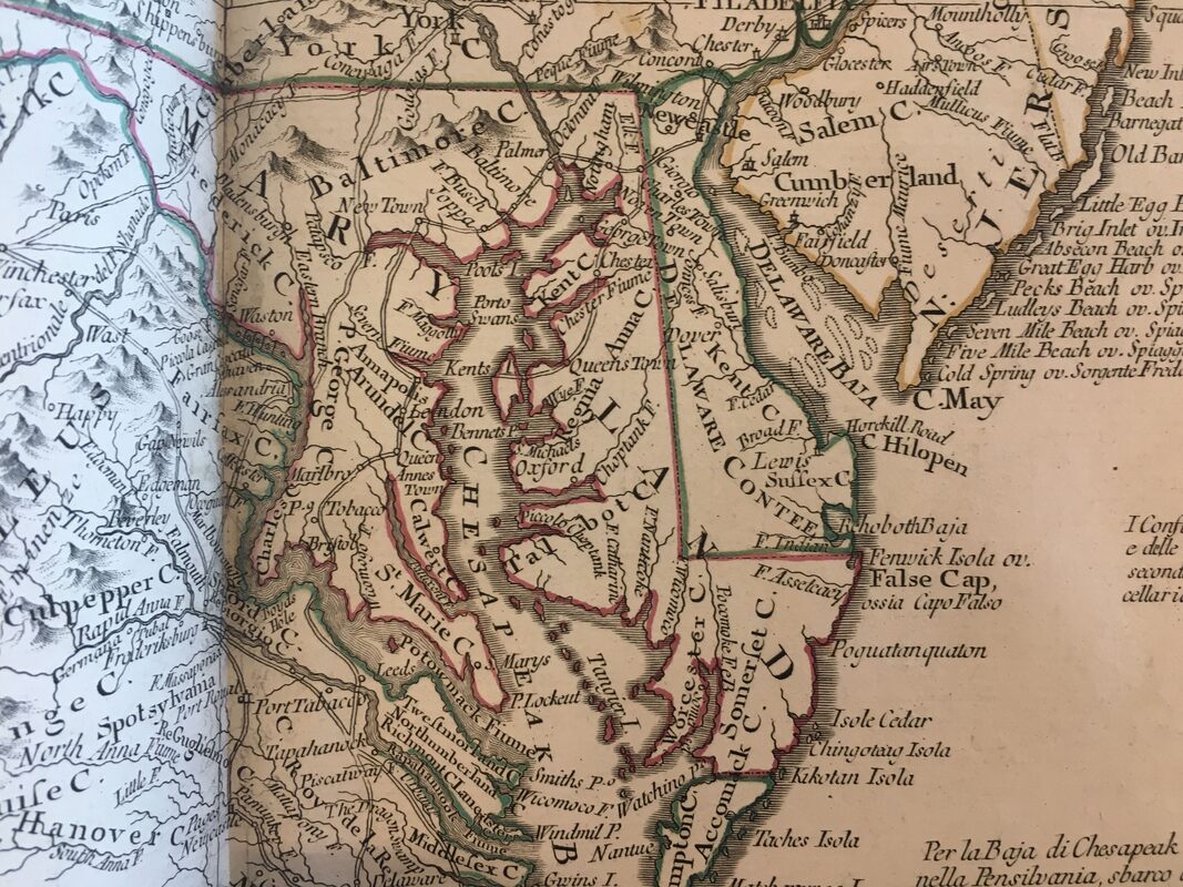
Maryland and Delaware / James Ford Bell Library, University of Minnesota Libraries
V - Maryland - Maryland is split by the Chesapeake Bay, and the land surrounding it proved good for growing tobacco. But like sugar, the crop needs near constant labor and Maryland colonizers used enslaved people of African descent for that labor. Goods moved mostly along the water, and Oxford on the eastern shore had a bustling trade.
Picture
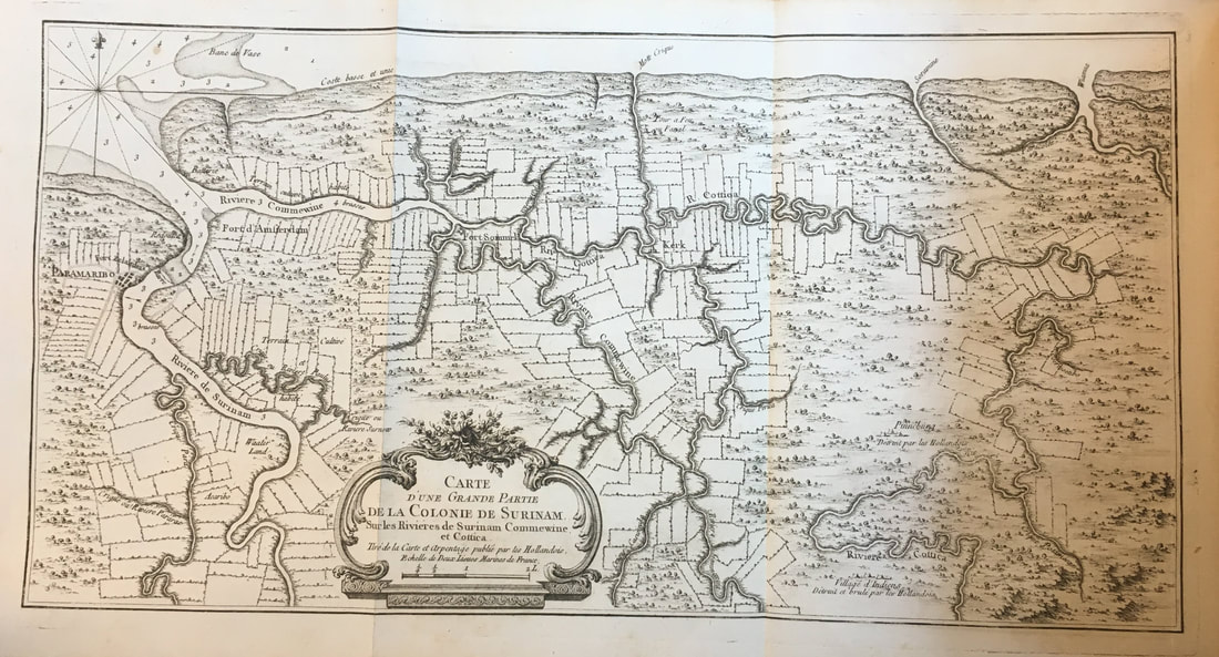
Map of Suriname (along the Atlantic coast) / James Ford Bell Library, University of Minnesota Libraries
VII / XV / XVI - Suriname - Suriname sits on South America’s northeastern coast, but Paramaribo is located a little bit inland on the Suriname River. Like in Maryland, the waterways were the primary method of transportation. This map lays out the property lines of plantations, where long skinny parcels give each owner access to the river.
Picture
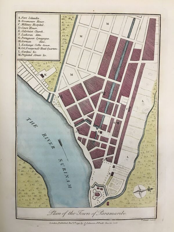
Plan of the Town of Paramaribo / James Ford Bell Library, University of Minnesota Libraries
VII / XV / XVI - ​Suriname - This map of Paramaribo was one the original illustrations for John Stedman’s book. 
Picture
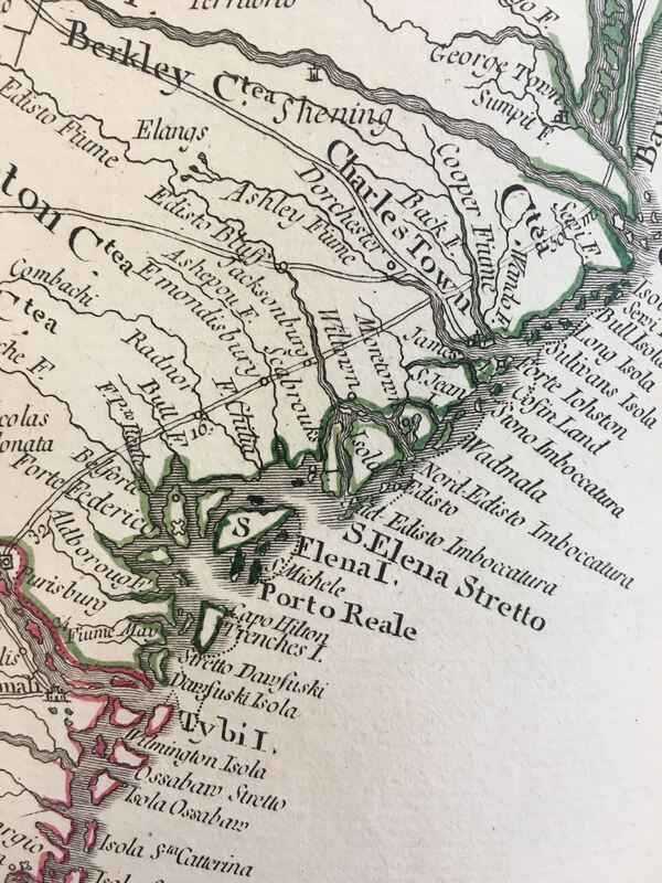
South Carolina coast / James Ford Bell Library, University of Minnesota Libraries
VIII / XIX - South Carolina - We don’t know exactly where John Rose had property on the South Carolina Sea Islands or where he painted the now-famous watercolor of enslaved people playing music and dancing. This map shows St. Helena (spelled Elena) Island and Port Royal. South Carolina Coast. 

Lucy McKim would travel to Port Royal during the Civil War and record songs she heard among the newly freed people there.

Picture
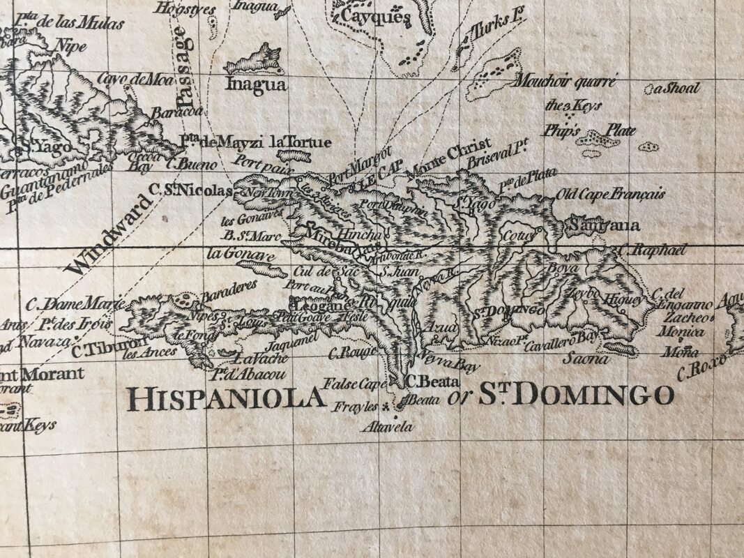
The island of Hispaniola (St. Domingue is on the left) / James Ford Bell Library, University of Minnesota Libraries
IX / XIV - St. Dominque / Haiti - St. Domingue and later Haiti make up half of the island of Hispaniola. Port-au-Prince lies on the western gulf, while Le Cap (first Cap Francois and then Cap Haitien) is on the northern coast.
Picture
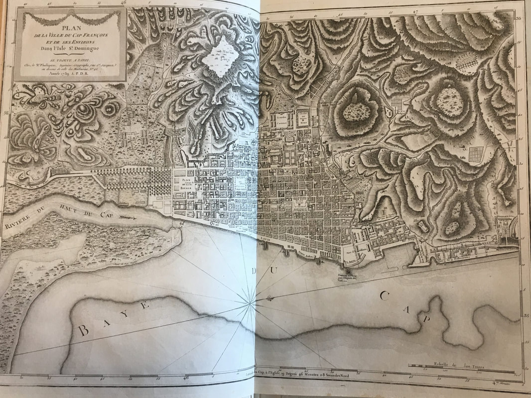
Plan de la Ville de Cap Francois / James Ford Bell Library, University of Minnesota Libraries
IX / XIV - St. Domingue / Haiti - In this map of Cap Francois, you can see the “Negroes Market” and La Fossette laid out on the left side of the image (the southern part of town)
Picture
Hudson Valley / James Ford Bell Library, University of Minnesota Libraries
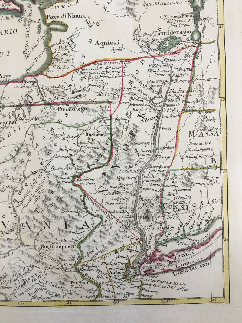
XI - Albany - Traveling up the Hudson River from Manhattan and New York City, you get to Albany. The vestiges of Dutch New York are still there in the place names around Albany.​
Picture
Map of the Plan of New Orleans / Library of Congress
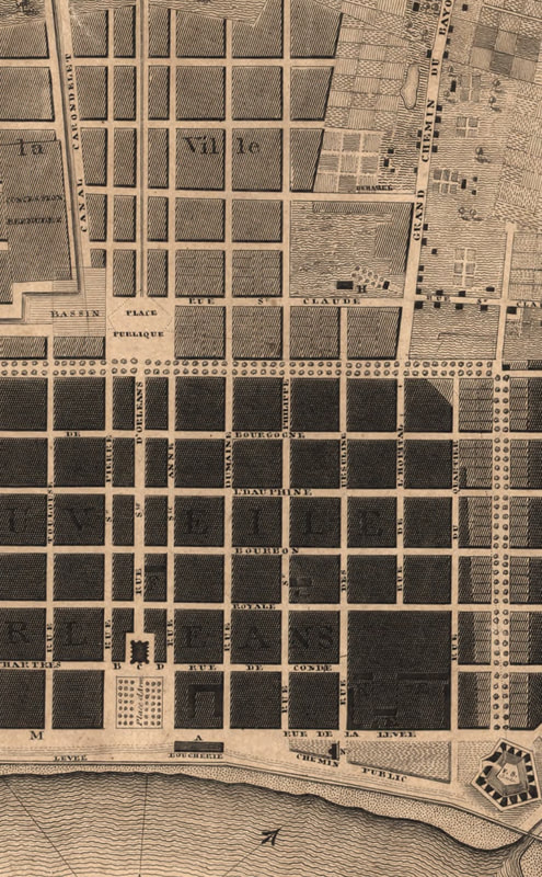
XIII / XVIII - New Orleans - An 1817 map of New Orleans showing the Place de Armes next to the Mississippi River and the French Quarter leading to the Place Publique, known today as Congo Square, and the Bayou St. John. Many of the accounts of African American music and dance in the city come from the levees, the space behind the city (what is today Congo Square), and the bayou leading to Lake Pontchartrain.
Picture
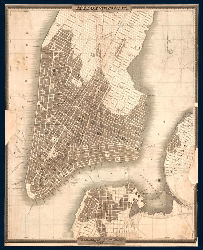
Map of New York City / Library of Congress
XVII - New York City - The city expanded tremendously between 1755 and 1840. What had been the Negro Burial Ground is now laid out as streets. The Minstrel musicians performed at theaters on the Bowery.

Link to original.
Picture
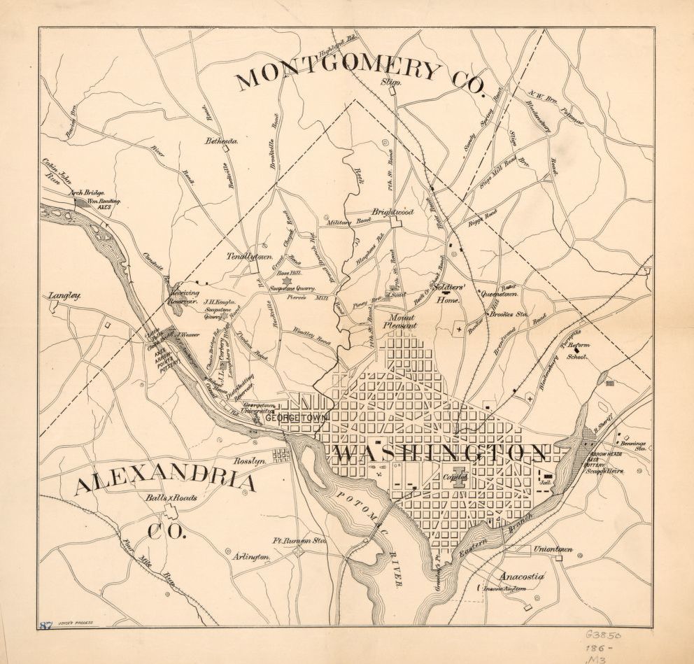
XIX - Washington, DC - Although much of the central part of DC had been laid out by 1860, much of the city was still being built, including the F street neighborhood where Eastman Johnson's father lievd.

Link to original.
This is part of Banya Obbligato, a series of blog posts relating to my book Well of Souls: Uncovering the Banjo’s Hidden History. While integrally related to Well of Souls, these posts are editorially and financially separate from the book (i.e., I’m researching, writing, and editing them myself and no one is paying me for it). So, if you enjoyed this as much as a cup of coffee, you can throw me a couple of bucks here.​
0 Comments


Leave a Reply.

    Picture

    Come in, the stacks are open. 

    Away from prying eyes, damaging light, and pilfering hands, the most special collections are kept in closed stacks.  You need an appointment to view the objects, letters, and books that open a door to the past. 

    Here, pieces of material culture are examined in the light. The stacks are open. ​Read the stories behind objects and ephemera found in private collections, archives, and museums. 

    Archives

    October 2022
    September 2022
    August 2022
    July 2022
    June 2020
    March 2020
    January 2020
    August 2019
    July 2019
    March 2019
    February 2019
    December 2018
    August 2018
    July 2018
    June 2018
    May 2018
    April 2018
    March 2018
    February 2018
    January 2018
    December 2017
    November 2017
    October 2017
    September 2017
    July 2017
    June 2017
    April 2017
    March 2017
    February 2017
    January 2017
    December 2016
    November 2016
    October 2016
    September 2016
    August 2016
    July 2016
    June 2016
    May 2016
    March 2016
    February 2016
    January 2016
    December 2015
    November 2015
    October 2015
    September 2015
    August 2015
    February 2015
    December 2014
    October 2014
    September 2014
    February 2014
    December 2013

    Categories

    All
    16th Century
    17th Century
    18th Century
    19th Century
    20th Century
    21st Century
    African American History
    African History
    Alcohol
    Alcohol History
    America
    Animal
    Appalachian
    Art
    Bad Science
    Baltimore
    Banjo
    Banjo Collector's Gathering
    Banjo History
    Banya Obbligato
    Banya Prei
    Books
    Canada
    Cancer
    Cat
    Celebrations
    Chesapeake Bay
    Chicago
    Christmas
    Circus History
    Civil War
    Clown
    Cold War
    Colonial History
    Communism
    Conjoined Twins
    Cook Books
    Crab
    Creole-bania
    Culinary History
    Devil
    Drumming
    Dutch History
    Easter
    England
    Eugenics
    Exhibits
    Fiddle
    Film
    Food
    Food History
    France
    "Freak Show" History
    German American
    German History
    Goucher College
    Halloween
    Hockey
    Hollywood
    Hospital
    Human Development
    James Ford Bell Library
    Jewish History
    Lincoln
    Lost Baltimore
    Lost History
    Lying In
    Lying-In
    Magazine Covers
    Map
    Maritime History
    Maroons
    Maryland
    Maternity
    Medical History
    Medical Procedures
    Medicine
    Metropolitan Museum
    Midwifery
    Minstrelsy
    Monsters
    Museum
    Music
    Native American History
    New Jersey
    New Orleans
    Newspapers
    New York City
    Obstetrics
    Ozy
    Patent
    Photography
    Plain Weave
    Political History
    Politics
    President
    Print
    Psychology
    Public Transportation
    Science
    Sheet Music
    Skansen
    Skeleton
    South American History
    Sports
    Stedman
    Streetcar
    Suffragettes
    Suriname
    Sweden
    Swedish History
    Theater
    The Knick
    Third Reich
    Traditional Music
    Traditions
    Transportation History
    Tri-racial Isolate
    Typeface
    Typography
    U.S.
    USA
    U.S. History
    Valentine
    Vegetarian
    Vegetarianism
    Victorian
    Violin
    Virginia
    Vodou
    Weaving
    West Africa
    West Virginia
    Winti
    Wisconsin
    Witch
    Witches
    Women
    Women's History
    World History
    World War II

    Picture

    RSS Feed

Proudly powered by Weebly
  • Books
    • Well of Souls
    • Flowers in the Gutter
  • Writing
  • Open Stacks Blog
  • About
    • Support My Writing
  • Contact